

| Federal sign standard | Manual on Uniform Traffic Control Devices (MUTCD) (Federal Highway Administration) |
| Number of base sign colors | 8 (plus fluorescent variants) (MUTCD, current edition) |
| Even-numbered interstates run | East-west (U.S. interstate numbering convention) |
| Odd-numbered interstates run | North-south (U.S. interstate numbering convention) |
| Unique shape reserved for stop signs | Octagon (MUTCD) |
| Color for work zone signs | Orange (MUTCD) |
Why Sign Design Is a Language, Not Just a Label
Every road sign in the United States follows a federal standard set by the MUTCD - the Manual on Uniform Traffic Control Devices, published by the Federal Highway Administration. This standardization means that color and shape carry meaning even before a driver reads a single word. Understanding that system helps you process signs faster and make safer decisions behind the wheel.
Think of road signs as a two-layer message: the visual code (color and shape) tells you the category of information, while the text or number tells you the specific detail. Drivers who recognize the visual code first can react more quickly - an important advantage at highway speeds.
| Federal sign standard | Manual on Uniform Traffic Control Devices (MUTCD) (Federal Highway Administration) |
| Number of base sign colors | 8 (plus fluorescent variants) (MUTCD, current edition) |
| Even-numbered interstates run | East-west (U.S. interstate numbering convention) |
| Odd-numbered interstates run | North-south (U.S. interstate numbering convention) |
| Unique shape reserved for stop signs | Octagon (MUTCD) |
| Color for work zone signs | Orange (MUTCD) |
What Each Sign Color Tells You
Color is the first cue your eye picks up, so the MUTCD assigns each color a specific meaning:
- Red - Stop, prohibition, or do-not-enter. Any sign with a red background or red border demands an immediate compliance decision. Stop signs, yield signs, and wrong-way signs all use red.
- Yellow - General warning. A yellow sign signals a change in road conditions ahead: curves, merges, pedestrian crossings, or signal ahead. It asks you to reduce speed and increase awareness.
- Orange - Work zones and temporary traffic control. Orange replaces yellow inside construction areas, flagging temporary hazards or altered lanes.
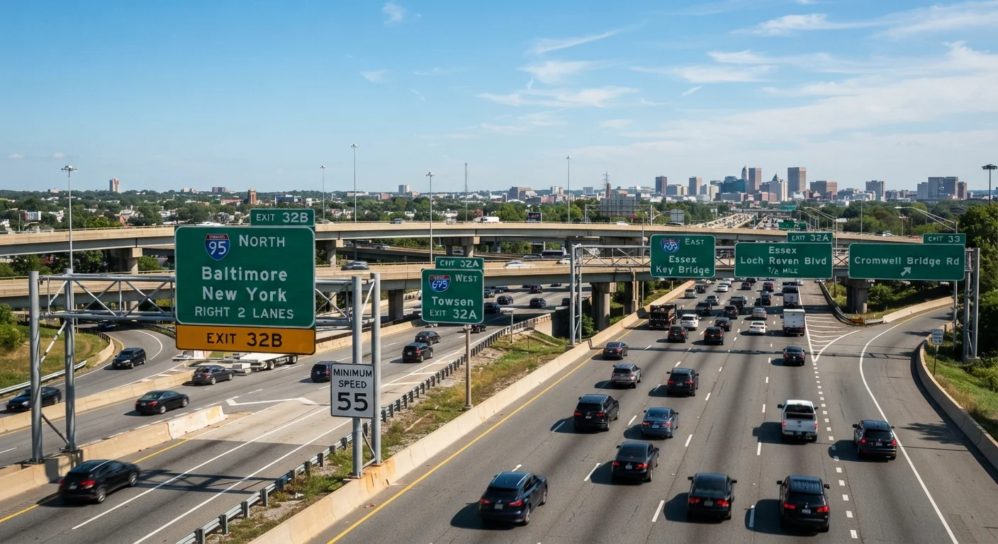
- Green - Permitted movements and guide information. Highway exit signs, distance markers, and directional signs use green to tell you where you may go.
- Blue - Motorist services. Gas, food, lodging, hospital, and accessibility information appear on blue signs, especially along interstates.
- Brown - Recreational areas and cultural points of interest, such as national parks, historic sites, and scenic byways.
- White - Regulatory information. Speed limit signs, lane-use rules, and most other legal requirements appear on white signs with black text.
- Fluorescent yellow-green - High-visibility warning for pedestrians, cyclists, and school zones. This color was added to the MUTCD to improve conspicuity in low-contrast environments.
Understanding yellow specifically can prevent one of the most common intersection errors. See why drivers misread yellow traffic lights for a closer look at what that color demands of you at a signalized intersection.
Shape as a Second Signal
Shape reinforces color and allows recognition even when a sign is partially obstructed by glare, weather, or vegetation:
- Octagon - Stop. Only stop signs use this shape in the U.S.
- Triangle (inverted) - Yield. The downward-pointing triangle is internationally recognized as a yield instruction.
- Diamond - Warning. All standard warning signs (curve ahead, deer crossing, slippery when wet) use the diamond shape.
- Rectangle (vertical) - Regulatory information, such as speed limits and turn restrictions.
- Rectangle (horizontal) - Guide or informational content, including street name signs.
- Pentagon - School zone or school crossing ahead.
- Crossbuck (X shape) - Railroad crossing.
MUTCD
The Manual on Uniform Traffic Control Devices is the federal document that standardizes the design, placement, and meaning of all traffic signs, signals, and pavement markings in the U.S. It is published and maintained by the Federal Highway Administration.
Regulatory sign
A sign that states a legal requirement drivers must follow, such as a speed limit, no-turn rule, or lane restriction. Regulatory signs are typically white with black or red markings.
Warning sign
A diamond-shaped, yellow sign that alerts drivers to a hazard or change in road conditions ahead, such as a sharp curve, intersection, or pedestrian crossing.
Milepost-based exit numbering
A highway exit numbering system in which each exit number corresponds to the mile marker at which the ramp begins. This helps drivers calculate distances between exits quickly.
Spur interstate
A three-digit interstate highway beginning with an odd number that branches off a main interstate route and terminates without reconnecting to it - typically leading into a city center.
Decoding the Numbers on Signs
Numbers on road signs communicate several distinct types of information depending on context:
Speed Limits
A white rectangular sign displaying a number under the heading "SPEED LIMIT" states the maximum legal speed in miles per hour for normal conditions. Posted limits may drop in school zones (often 15-25 mph when children are present) or increase on rural interstates. The number is a legal ceiling, not a recommended target - conditions may require driving well below it.
Route Numbers
Route numbers appear on distinctive shield-shaped markers. Interstate highways use red, white, and blue shields. Even-numbered interstates run east-west; odd-numbered ones run north-south. Three-digit interstates beginning with an even digit are loops through or around a city; those beginning with an odd digit are spurs that branch off the main route and do not reconnect.
U.S. routes appear on black-and-white shields; state routes use shapes that vary by state. Knowing whether a route number is even or odd gives you a quick directional orientation without a map.
Distance Markers
Green guide signs on highways display distances to upcoming cities or exits in miles. Mile marker posts - small numbered signs along the roadside - count miles from a state's southern or western border and are invaluable for reporting your location to emergency services.
Exit Numbers
Most states now use consecutive or milepost-based exit numbering. Milepost-based exit numbers (the more common system) correspond directly to the mile marker where the exit ramp begins, making it straightforward to judge how far you are from a destination.
Just as understanding dashboard symbols helps you interpret vehicle alerts - see what your car's warning lights are actually telling you - mastering sign literacy helps you interpret the road environment with equal confidence.